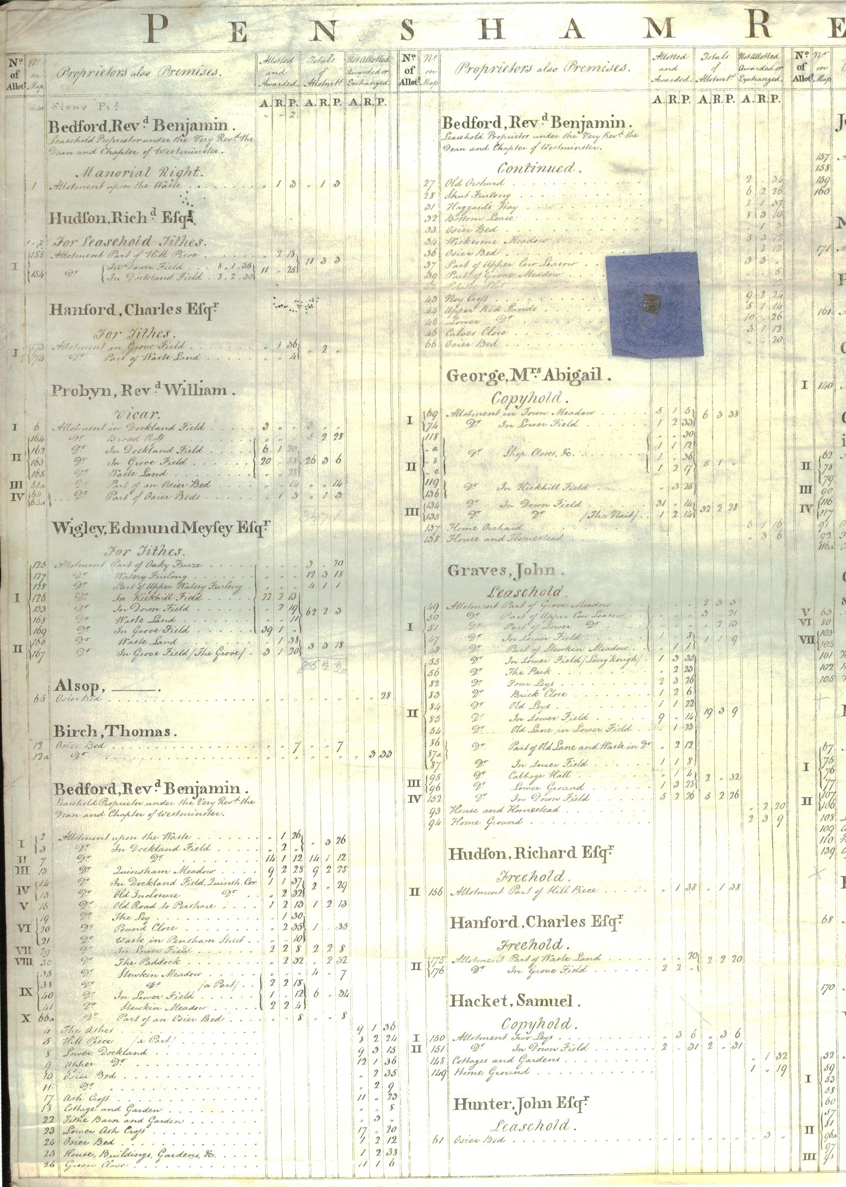
Pensham and the Graves Family.
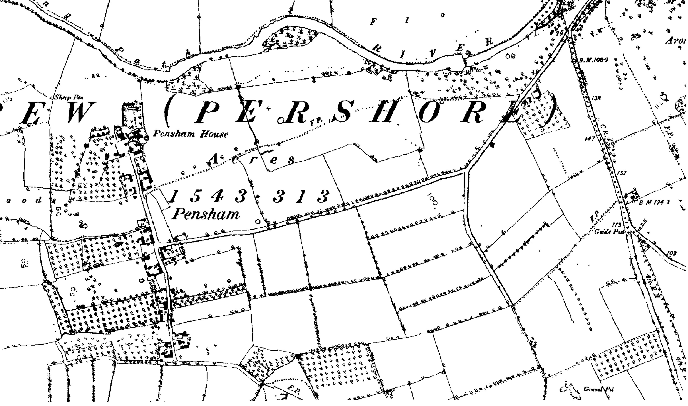
On Saturday 18th September 2004, Lionel and Richard Graves, armed with cameras and an 1812 map showing the enclosures (or inclosures) that had taken place in Pensham, went to see if they could find the fields leased by John Graves from the Dean and Chapter of Westminster Abbey.
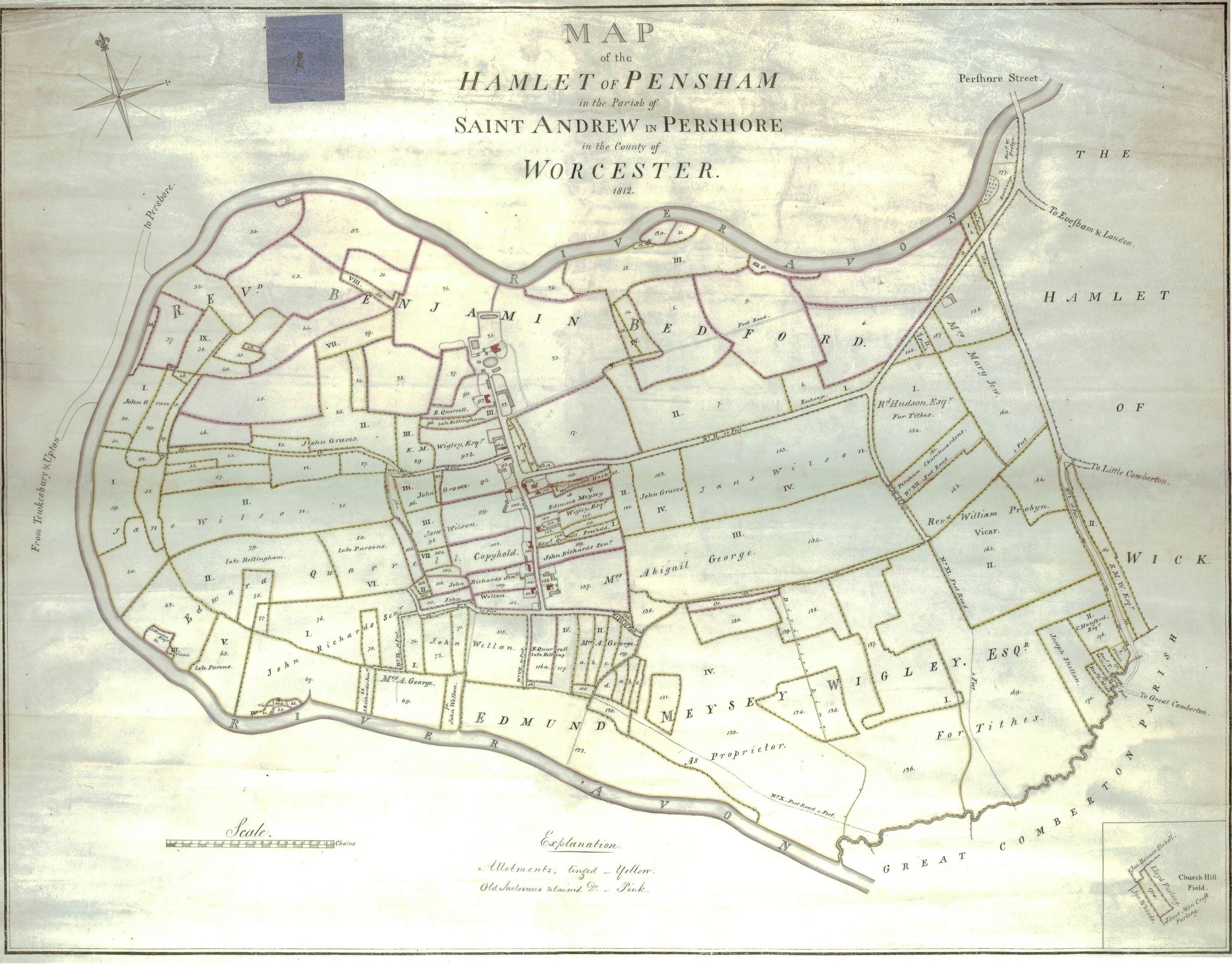
This is the 'Map of the Hamlet of Pensham', showing John Graves's farmhouse and outbuildings (No.93), in 1812.
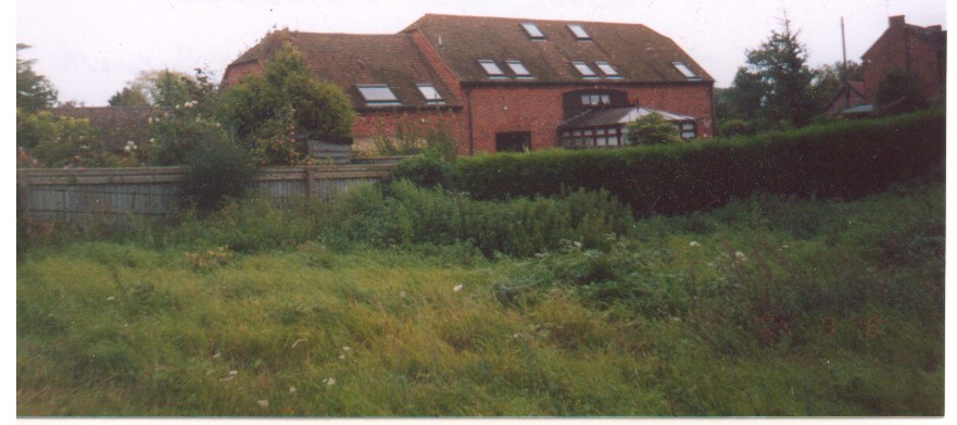
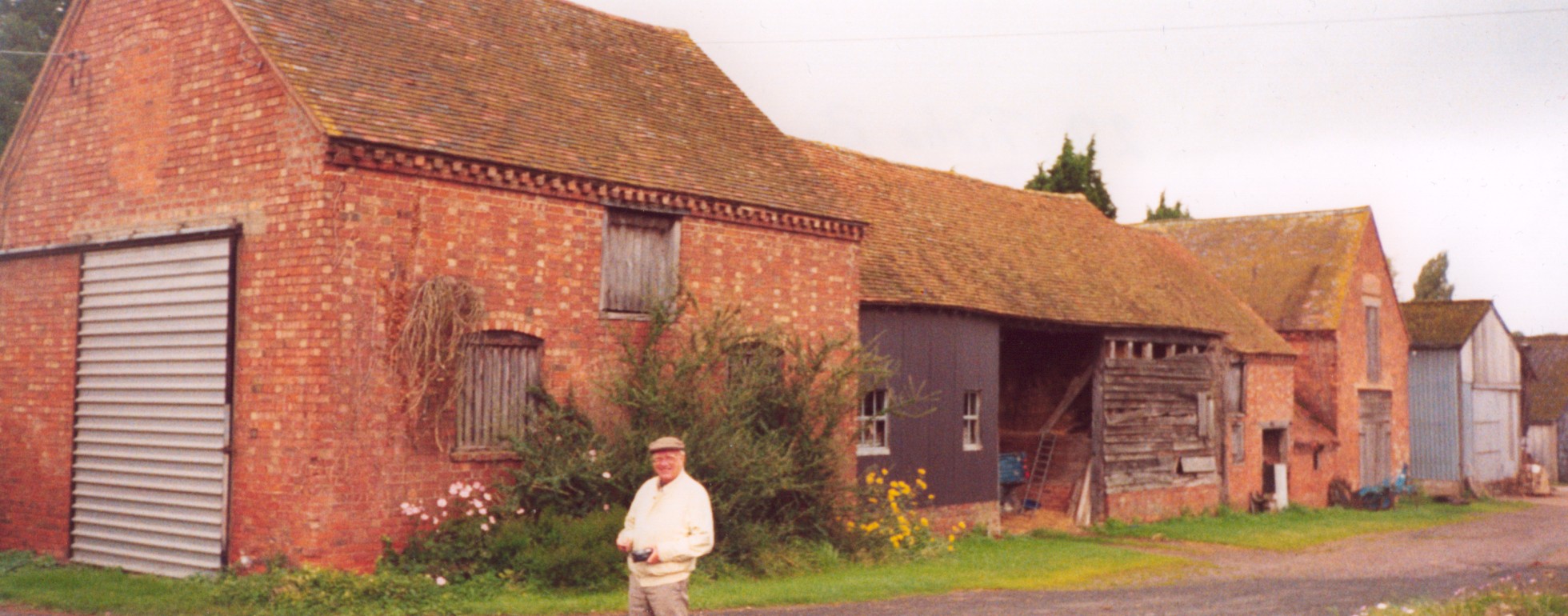
The original barn, shown to the right of the No. 93 on the enclosures map, as it is today, viewed from the road. It was converted into a garage for the barn conversions shown below.
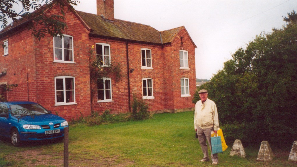
The photograph above shows Manor Farm today. The modern barn conversions used the original barn, seen on the left, and later barns built in 1840 (shown in the middle and to the right).
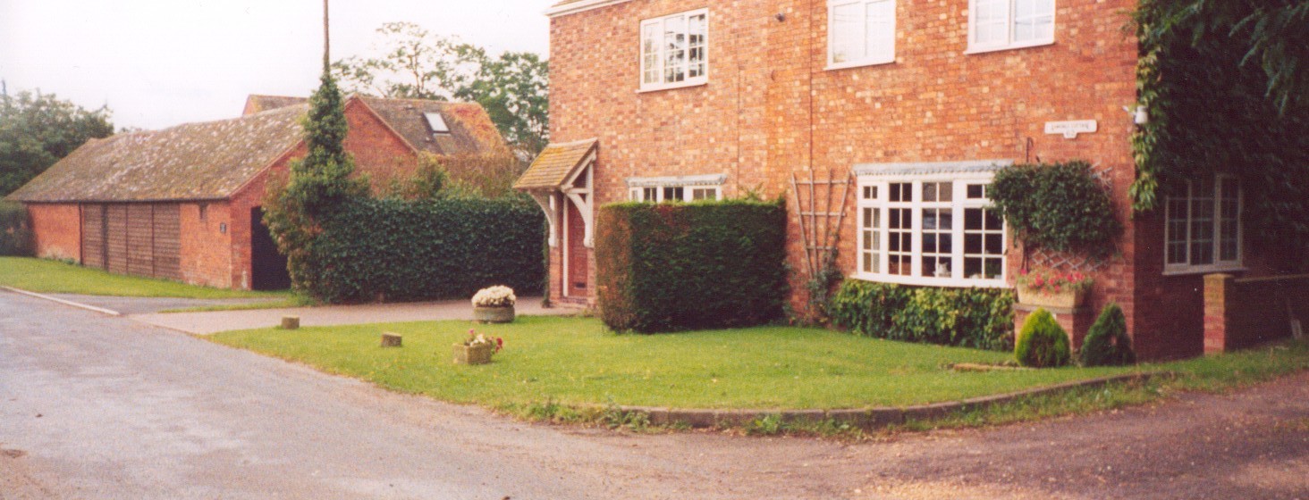
This picture shows Manor Farm from the back.
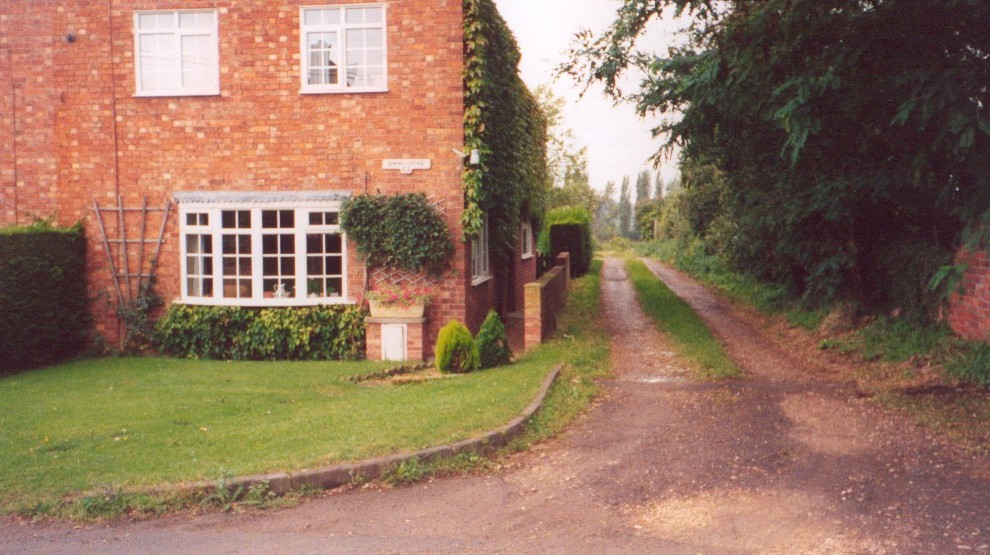
This picture shows the site, taken from the road in front, the two semi-detached houses are where the original farmhouse building stood. To the right is the start of the farm track shown of the Enclosures map. The track is shown more clearly below.
Lionel Graves at the house once owned by Edward Quarrell, No. 92 on the map.
The Pensham House No. 25 on the map was no longer there, we were later told it had been demolished years ago, but the Tithe Barns, No. 22 on the map, were still there (see above). This is where the Reverend Benjamin Bedford was leasehold proprietor under the Very Reverend the Dean and Chapter of Westminster.
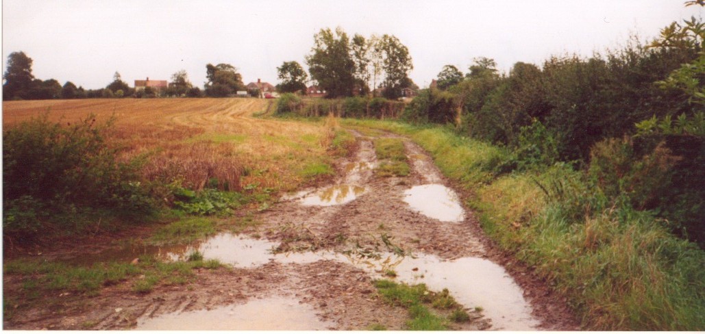
Back to the farm path. Graves family men, women and children would have walked this lane to worked in the fields or orchards. I think they would recognise the scene today, though according to the old map the track had hedges on both sides.
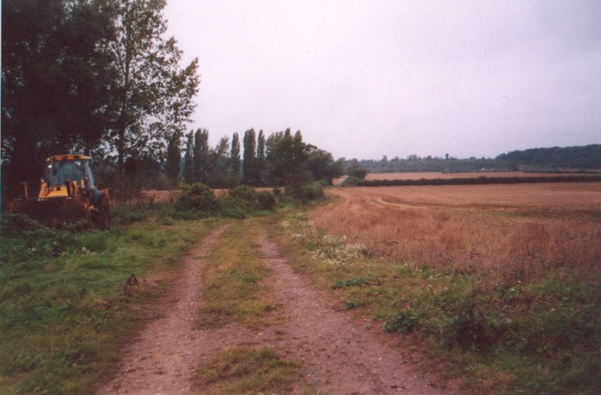
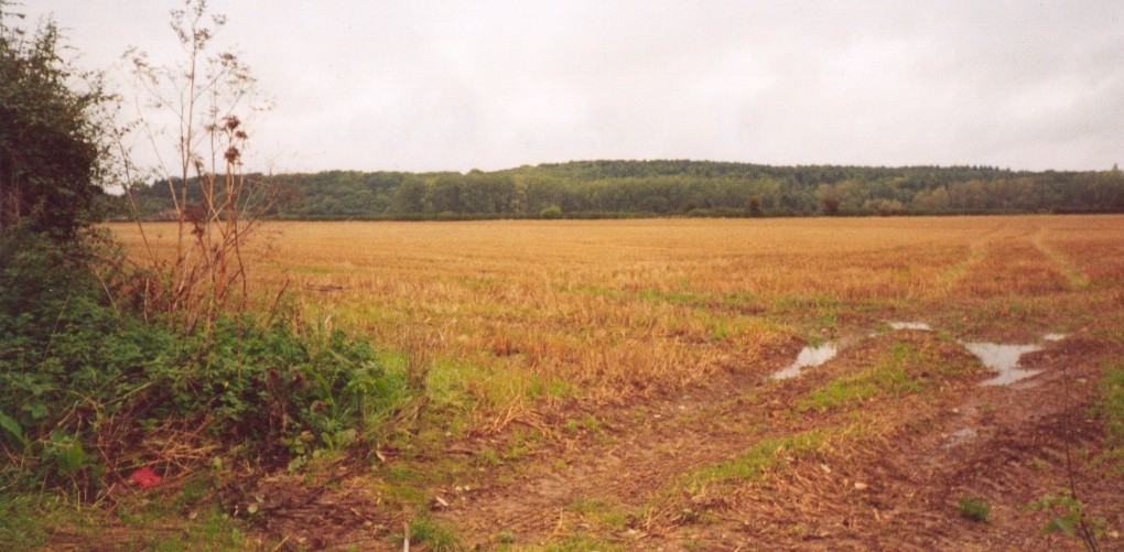
The photograph above shows the field called Lower Ground No.96 on the map, leased to John Graves.
This shows where the track runs out today in the field once owned by Jane Wilson, No. 81.
This picture was taken the other way looking back towards the farmhouse, which can just be seen on the horizon. The field on the left belonged to E. M. Wigley Esq. No.92b.
More of John Graves's land, the Old Leys (No.84) and Brick Close (No.83), Lower Field (No.85 & No.87). The colour of the stubble is deceptive, it has been a shockingly wet summer and a lot of the crops couldn't be harvested and the grain was lying blackened and soggy underfoot.
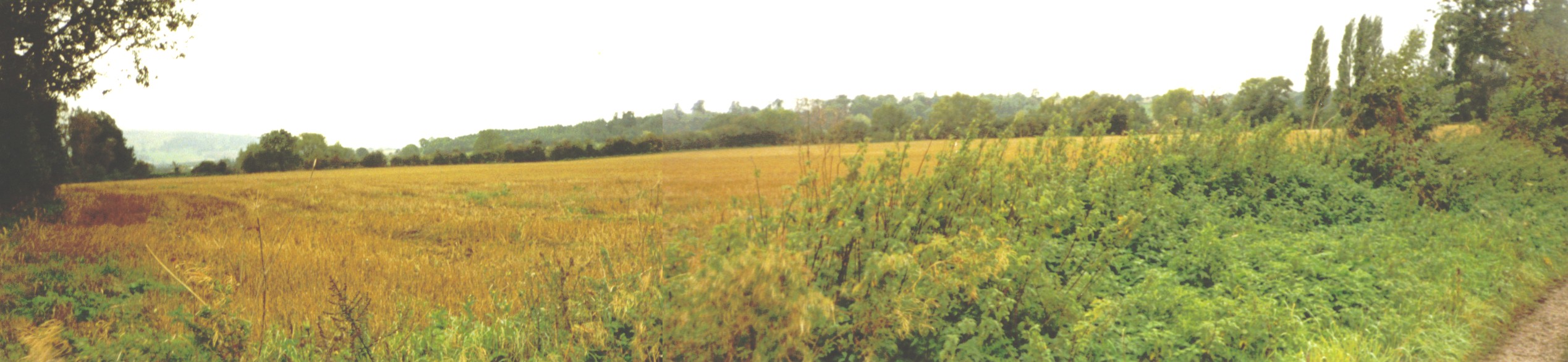
A montage showing the fields called Cabbage Hall (No.95) and Lower Ground (No.96). The trees and woods are on the other side of the River Avon, which loops right round Pensham, but we couldn't see where the land drops down to the river and did not have time to go and photograph it.
They must have farmed it between about 1762 and 1879 when Littlebury's Directory has a 'Thomas Greaves, Farmer, Pensham, (could have been longer).
Map of Pensham today showing Manor Farm.
Map of Pensham in 1888, which shows some of the land as orchards.
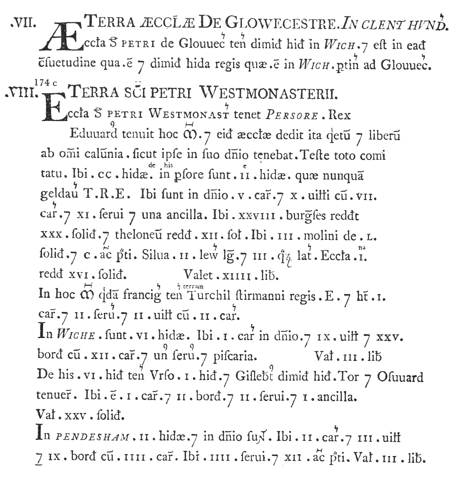
The Pershore and Pensham entry in the Domesday Book of 1086 A.D.